|
Community Services
Community Services

: For students: Youssef Al-Ahmari - Abdullah Al-Sheikh
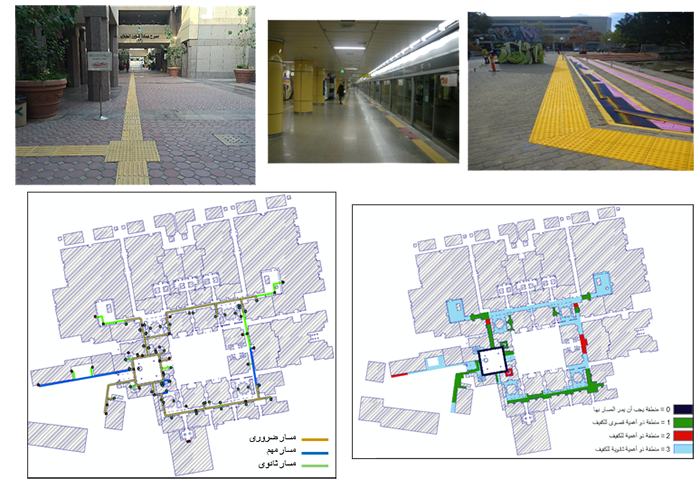
One of the rights of the blind in society is to integrate them into everything that makes them live a normal life, such as education and job opportunities. Therefore, it is necessary to provide all services for this precious group to travel and move to obtain all their rights without obstacles preventing them from doing so. The project deals with the idea of providing solutions based on geographic information systems in order to facilitate the process of moving the blind in the external environment of buildings and facilities by creating tracks for the blind based on tangible ground indicators (TGSI) and using these tracks to provide indicative information for the environment surrounding the blind to serve as a navigation system to facilitate movement And move him safely. The project is implemented by studying and defining the standards and specifications for the external environment and the people involved in the project, then creating a database that shows the conformity of the external environment with the standards and specifications for facilitating movement for the blind. After conducting spatial fit analyzes to extract the paths, these paths were linked to semantic information, and finally, a network of navigation paths was established. This product helps in the correct orientation and visibility of the problems that the blind may encounter outside the built environment as well as the ability to move safely and independently. In addition, additional results can be provided such as showing areas that do not match the standards and alerting the responsible authorities to do what it takes to provide an external environment that matches everyone's needs.
|
Last Update
10/24/2022 11:41:57 PM
|
|
|
|